


This website uses cookies so that we can provide you with the best user experience possible. Cookie information is stored in your browser and performs functions such as recognising you when you return to our website and helping our team to understand which sections of the website you find most interesting and useful.
ABOUT THE OWNERS
Welcome to Always Best Care Serving Chapel Hill & Durham
Always Best Care of Chapel Hill & Durham combines national strength and standards with local accessibility and personal service. We specialize in providing personalized, non-medical care for seniors who wish to remain in the comfort of their own homes. With a large team of Certified Nursing Assistants & Trained Caregivers, our talented staffing coordinators will work to find you the perfect care giving solution in a timely manner. We quickly arrange a schedule that works for you – hourly, overnight, or live-in.
Each client has an individualized care plan which ensures that they receive consistent high quality care and services that allow them to safely remain their own environment. All of our caregivers have passed through our rigorous screening process and are bonded, insured, background checked and drug tested. For those that are interested in senior housing options, we can help you with our assisted living placement service*.


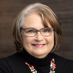
MEET OUR TEAM
Our Team of Experts
Committed to Providing the Best Care and Support
Experienced healthcare and caregiving professionals
serving you
Communities Served
Your local Always Best Care team helps families throughout Chapel Hill and the surrounding areas


ALWAYS THERE FOR YOU ALWAYS BEST CARE
NEED CARE TODAY?
Contact Us For Care Consultation
Always Best Care helps seniors and their family through the entire process. Our care coordinators are local and have in-depth knowledge of our senior living partners and services.


Ready To Answer Your Questions
FAQs About Our Senior Care Services


It’s becoming more and more common for families to live far apart from each other, and leaving an elderly relative alone at home can be a major source of anxiety if you’re not nearby. Always Best Care provides the reassurance you need that your loved ones are safe and happy, with a compassionate caregiver available in case of an emergency. We’ll help them handle their daily tasks so that you can manage your own life with confidence and peace of mind. In addition, home care is often considered a healthier and more affordable option for families when compared to long-term nursing facilities.
Choosing an in-home senior care provider can be a daunting task. However, there are a few guidelines to keep in mind. First, ask your friends and family for recommendations. If you’re unable to get any suggestions, search for local and state organizations that recognize the best providers in the industry. Doing so can help narrow down a shortlist of home care agencies. Next, set up meetings with your top choices and ensure that they meet your criteria. Don’t forget to ask your senior for their opinion, too. Doing so will help you make an informed home care decision.
When hiring an in-home care provider, it’s important to ensure that they are insured to protect you and your loved one. Always Best Care not only provides our clients with insurance coverage but also Worker’s Compensation. That way, in the unlikely event that an accident occurs while a caregiver is working in your loved one’s home, you are protected against any claims or damages. These protections not only benefit you and your loved one, but also directly benefit our caregivers, enabling us to attract some of the most skilled and compassionate individuals for Home Care in Chapel Hill.
In the mid-90s, Always Best Care founder Michael Newman grew frustrated by the lack of resources available for seniors in his community. That frustration helped him shape a vision: to create a home care company that would provide trusted care, compassionate support, and professional advice for seniors and their loved ones. In 1996, Michael channeled his frustration into founding Always Best Care, which has since become one of the nation’s leading providers of in-home care for seniors. Today, people with passion continue to make Always Best Care what it is today. While times may change, our company’s commitment to compassionate home care will always remain the same.
To provide the best home care in Chapel Hill, we believe that it’s crucial for seniors and their caregivers to build a strong relationship that is fortified with trust. Without it, all parties can suffer. However, at Always Best Care, our caregivers are allowed requested vacations. There may also be times when caregivers become ill. In such cases, a substitute caregiver takes responsibility for your loved one’s care. We inform the substitute caregiver about all your loved one’s likes and dislikes to minimize disruptions. If additional care is required in the morning, afternoon, and evening, we will do our best to accommodate.
We understand that many seniors can lead mostly independent lives, but occasionally they may need assistance. At Always Best Care, we’re thrilled when we can schedule a caregiver in a very short turnaround. That’s why we’re happy to offer part-time in-home care for seniors in Chapel Hill. Our team of compassionate caregivers can be `available to assist your senior loved one morning, noon, and night.
Our home care providers in Chapel Hill can assist with a wide range of services to help your senior live a fulfilling, independent life at home. Some of our most requested home care services include the following:
• Light Housekeeping
• Medication Reminders
• Community Activity Escorts
• Companionship
• Meal Prep
• Nutrition Monitoring
• Incontinence Care
• Transportation and Errand Running
• Dressing and Grooming
Contact our Always Best Care office today to learn more about the additional home care services we offer.
We believe that safety is one of the most important aspects of home care in Chapel Hill. As such, we train our caregivers to assess your senior loved one’s home to identify any potential hazards that could lead to accidents. Before providing in-home care services, we will perform a safety assessment of your loved one’s property to identify ways to make their home safer. This may include introducing grab rails in hallways or showers or making other small changes. To ensure ongoing safety measures are met, your caregiver will continue to monitor your senior’s mobility and recommend any necessary equipment or technology to make their life easier and safer.
Yes. We understand that, with time, a senior’s home care needs can change. If they do, your Care Coordinator will be there to re-evaluate and adjust your non-medical home care services in Chapel Hill as needed.
Our senior home care providers in Chapel Hill are dedicated to delivering compassionate, exceptional care. That dedication often translates to specialized training and preferred areas of focus. Please don’t hesitate to inform us of any unique health needs or requirements your loved one has during your care consultation with Always Best Care.