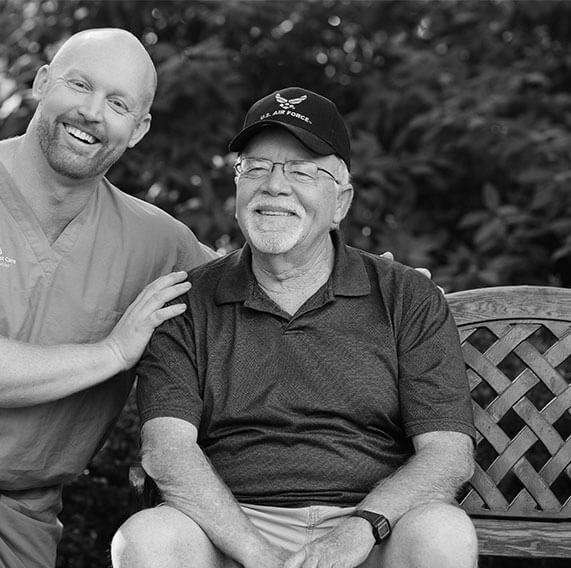
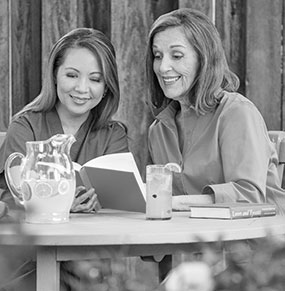
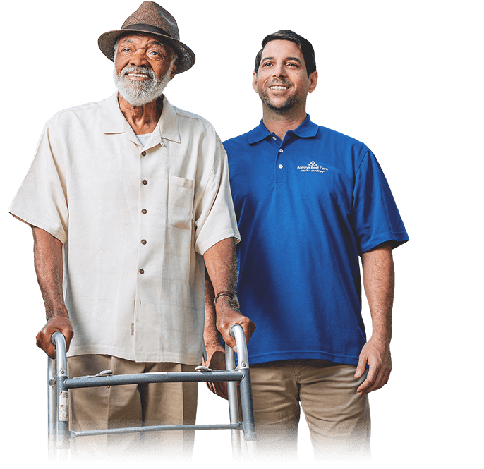
Team of Caring Professionals
We are a team of caring and compassionate professionals working together to provide the best possible care for you and your loved ones
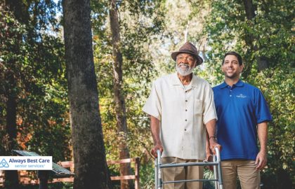
Always Best Care combines national strength and standards with local accessibility and personal service. The owner of Always Best Care of Palm Desert is Eiso Wortelboer. Eiso and his team have your loved ones best interests at heart, and will ensure that exceptional service and care is provided to all family members.
We are proud to serve the Coachella Valley area including the desert cities of Palm Springs, Indian Wells, and Palm Desert.
If you find yourself in Orange County, we invite you to check out our sister office Always Best Care of Irvine. Reach out to them for a complimentary living room visit today!
We have strong relationships with area hospitals, social workers, senior communities and senior resources throughout the county. Caregivers at Always Best Care Indian Wells are licensed, bonded, and insured to provide the safest and highest level of care.
There’s no charge for a care consultation or for assisted living referral services*.
*Because Always Best Care is compensated by our contracted assisted living communities, we are happy to provide our senior housing and assisted living referral services at no charge to you

We match our clients with the most appropriate living options

We are a team of caring and compassionate professionals working together to provide the best possible care for you and your loved ones
We have worked with thousands of seniors and their families across the U.S. and Canada, providing the best service each step of the way
Our team of professional caregivers has a proven track record of providing expert care to seniors and people with special needs
We help people with specific needs maintain a safe, independent, and dignified lifestyle with in-home care, senior community referral services and special care services
Discover our services to find the right care solution for you and your loved ones

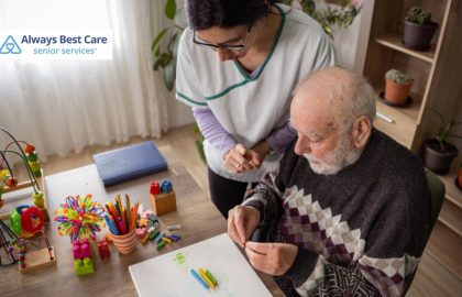
Expert care services, delivered in the comfort of your home
Referral services designed to help you find the right senior living community
Specialized health monitoring services, powered by advanced healthcare technology
Helping veterans navigate the financing options available from the VA to receive the best care possible
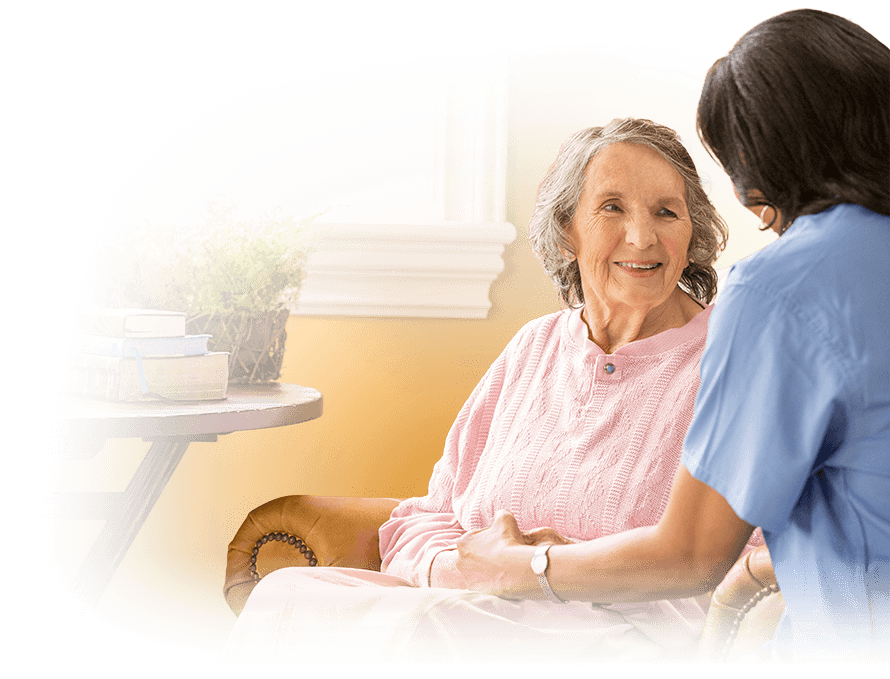
Your local Always Best Care team helps families throughout Palm Desert and the surrounding areas


ALWAYS THERE FOR YOU ALWAYS BEST CARE
“Always Best Care responded to my needs quickly and efficiently . I was drowning with”
“I am a current client of this provider I am using Always Best Care of Desert”
“Always Best provided excellent physical care as well as very caring emotional support during this”
“Our family experience an unexpected complex situation. We are so grateful for the support we”
“Always Best Care Senior Services has been a lifesaver. I have a cousin who lives”
“Abc has top notch people working in the office who deal with issues in a”
“Always Best Care has provided us with personalized, kind, reliable and professional help when we”
“ABC has been amazing from the get go. To setting up service , to answering”
“You all were amazing. We couldn’t have done it without Freddie. Amazing. Cudos to Sandra”
“I can’t say enough good things about Always Best Care. They were prompt and courteous,”
“Elsie the care giver was amazing with my Godfather, very very caring, always going above”
“I just wanted to give Always Best Care a very well deserved 5 star review!!”
“Always Best Care provided 3 day a week help for my sister while she was”
“Above and Beyond I was driving in a panic from Washington to California because my”
“Always Best Care is always responsive and easy to work with. My husband’s caregive, April,”
“We only use them occasionally on the weekends, so they’re not really impacting her daily”
“My experience has been positive because the caregivers do what I ask them to do.”
“We appreciated the prompt response from Always Best Care. Sandra was so professional and was”
“This was our first time working with this company and they did not disappoint! I”
“I couldn’t be more pleased about my caregiver, Zulie, during the time that she was”
“The agency has given me free time and they are very responsive. I like the”
“She did not need a lot of instruction. We had one caregiver for two days”
“The caregivers are always on time. I like that they have been very dependable.”
“I’m a grateful, former Caregiver/Home Care Aide employee with Always Best Care. As I advanced”
“The care is very good because they do everything they are supposed to do. I”
“They’ve been there to give me whatever I need. I’ve used them for a very”
“Our experience with Always Best Care was 5-star. Sandra Mendoza, care co-ordinator, was very thorough”
“They have available talent whenever we have needed it. The prior agency had limited services”
“I have been a client with Best Care for about three months and I have”
“The caregivers help with personal hygiene and laundry. The agency is flexible and conscientious.”
“I like that they seem to be very knowledgeable.”
“We are so pleased with the professionalism and care of this team. Both Jessica C.”
“Sandra has been taking really good care of my dad! Also, Jessica C. Will always”
“Always best care has been amazing for my grandma. Juan Garcia is my guy to”
“Pleasant, competent service. My caregivers, especially Amy, were terrific.”
“We’ve been very pleased with the services that Always Best Care has provided for my”
“They keep him safe. They’re very friendly and good with my husband.”
“This group of care takers could not have been more amazing to our cousin William”
“Very competent and professional. Best in home health.”
“They could clean through the night, and we have some that come in and sleep”
“Always Best Care responded to my needs quickly and efficiently . I was drowning with care giving and they provided a care giver with very short notice. They also worked with me for the time I would need help, even though it was not the normal working hours. Some say care giver services are too expensive but I found their rates reasonable and worth more that i paid given the peace of mind i got .”
“I am a current client of this provider I am using Always Best Care of Desert Cities for my parents. I think we are about eight weeks now. Initially, it was in-home care eight hours a day, and it has just been boosted to 24 hours a day. They provide light housekeeping, meals, and activities of daily life. The staffing is very consistent. They’re very good people.”
“Always Best provided excellent physical care as well as very caring emotional support during this very trying time for our family. Sandra Mendoza was always professional and extremely knowledgeable in her role. She was always available to answer questions. Our family would like to especially acknowledge Marissa, one of the aides, who was extremely kind and knowledgeable. She has a very kind heart, and supported us during the transition of our family member.Thank you very much”
“Our family experience an unexpected complex situation. We are so grateful for the support we received, the timely manner in which all issues and questions were worked thru and responded to, and the compassionate and professional care we received. Sandra was knowledgeable and so helpful and Maria, (a caregiver) was tender… offering a friendly smile when tears welled up. We would have been lost and struggling without Always Best Care.”
“Always Best Care Senior Services has been a lifesaver. I have a cousin who lives several hundred miles from me. She has Alzheimer’s and it’s very hard to take care of her from here. I’ve had other care services before and they didn’t work out because they sent a different caregiver every day and it was very confusing and upsetting to my cousin. ABCSS has been fabulous at providing continuous care. My cousin adores her caregiver Melissa. She takes her swimming and shopping etc. Also, I cannot say enough good things about Sandra Mendoza. Because I live far away, it’s hard to know what’s going on. She keeps informed and updates me by email and text message. She calls me if there’s a problem. What more could you ask for?”
“Abc has top notch people working in the office who deal with issues in a swift and caring fashion. Especially Juan and Moises who go the extra mile when there’s an issue. As for caregivers Jessica Perry who is beyond the best I’ve ever had. She’s on top of things each day and makes having someone around the house not so bad. She gets 100% my other main caregiver Daisy, is also terrific and smart. Both of these care givers know how to think, be aware of what’s happening and maintain great attitude each day. Zap-Roxie”
“Always Best Care has provided us with personalized, kind, reliable and professional help when we needed it most. They have made all the difference during our transition to an increase in home health care needs. I am so grateful for them! They will continue to be our trusted partner.”
“ABC has been amazing from the get go. To setting up service , to answering all my questions during this stressful time, to finding the absolute best caregiver lizzette that my mom actually enjoys spending time with:) everyone here is kind, full of patience and willing to help from beginning to end. Don’t know what I would do without their help. Grateful for finding them”
“You all were amazing. We couldn’t have done it without Freddie. Amazing. Cudos to Sandra and Moises. Will miss you all.”
“I can’t say enough good things about Always Best Care. They were prompt and courteous, met with me the same day as my Mom was being discharged from the hospital, and I needed to arrange care. Janet was the caregiver provided for my Mother. She was so kind and attentive to my Mom, also very concerned about her safety. She went over and beyond what I would have expected, and my Mom really bonded with her. I also used placement services as my Mother formerly was in assisted living but needed to move to a board and care for more care and monitoring. I was shown several beautiful homes by Bonnie Zwack who was personally invested in finding the right fit for my Mother. She even visited my Mother to ensure a positive transition. Thank you so much ABC! You lifted a huge burden off of my shoulders that at first seemed overwhelming. I’m sharing a picture that Janet helped my Mom color during an activity. Moved me to tears. Sincerely, Linda Devore”
“Elsie the care giver was amazing with my Godfather, very very caring, always going above and beyond with his needs”
“I just wanted to give Always Best Care a very well deserved 5 star review!! As children of seniors know, it can be a hard decision to entrust others outside of the family to provide love and care for your aging parent. However, Always Best Care of Indian Wells has been incredible in so many ways in helping facilitate home care service for my 100 year old mom. Sandra, their Care Coordinator, is an excellent communicator – patient and kind, resourceful and so very competent. Yvonne, mom’s caregiver, is loving and from our first meeting, she did those “little things” without being instructed that were important and mean so much. (Like checking dates on groceries, asking about parking so as to be considerate of the neighbors, having a routine for where to put things like mom’s keys, etc., and just focusing her attention on little things that were all about mom, etc. etc.) Moses, who installed mom’s AI devices was great as well – all smiles, so friendly and sweet to mom. And Juan, who does scheduling is the best as well….always one step ahead in communicating schedules and everything else. I am very impressed with how well they all work as a team. The most important part, though, is that mom is happy! Thank you ABC!”
“Always Best Care provided 3 day a week help for my sister while she was recovering. They did a great job attending to her and making her life simpler. I know my sister enjoyed the company and help. She was sorry to see it end! I would highly recommend Always Best Care to help you over the rough spots.”
“Above and Beyond I was driving in a panic from Washington to California because my mother was in crisis, she has dementia and her partner/care giver was taken to the hospital and not expected to recover. From the moment of contact while driving through mountains with terrible cell service Sandra and Moses took the situation in hand and offered solutions and managed to obtain a nurse for that very night with such short notice of only 3 hours and we needed care for 12 hour shifts. They were so compassionate and supportive and made us feel safe. Mom is 88 years old and can be quite difficult in the best of times, she really liked the nurses and wanted them to come back. Anyone needing Nursing services should call Always Best Care they are top notch. Thank you again for the amazing service!”
“Always Best Care is always responsive and easy to work with. My husband’s caregive, April, is fantastic. Very smart and he listens to April!”
“We only use them occasionally on the weekends, so they’re not really impacting her daily life. They seem really easy to communicate with, and they’re open and eager to meet the needs that we have.”
“My experience has been positive because the caregivers do what I ask them to do. I like Always Best Care because they are very efficient.”
“We appreciated the prompt response from Always Best Care. Sandra was so professional and was able to explain and answer all of our questions. The care that our Mom received from Jestina was exactly what we wanted and needed. Jestina was so sweet and kind to Mom and Mom just loved her. Thank you so much for helping our family and especially our Mom.”
“This was our first time working with this company and they did not disappoint! I needed to hire a night nurse for my Mother who just got out of the hospital and I was so nervous about it but after meeting with Sandra, she put our minds at ease! She was so professional, kind and understanding! She paired us with Nancy who ended up being such an angel. My Mom was comfortable and happy every night she was there! They had a great time together! Each morning Nancy made sure to provide me with updates which was so appreciated. I cannot express how amazing this experience was. Book them for all your needs! Thank you again!”
“I couldn’t be more pleased about my caregiver, Zulie, during the time that she was with me. She was always willing to help and make sure everything was easier for me. I always hoped that the others would be a clone of her. ABC always responded quickly to my requests and everyone I talked to was very helpful. Thank you to all who assisted me while I was with ABC.”
“The agency has given me free time and they are very responsive. I like the agency because the caregivers have all been good.”
“She did not need a lot of instruction. We had one caregiver for two days who was excellent.”
“The caregivers are always on time. I like that they have been very dependable.”
“I’m a grateful, former Caregiver/Home Care Aide employee with Always Best Care. As I advanced my career in Healthcare, I will forever look back and smile for my experience working with Always Best Care Seniors. I appreciated the opportunity to meet great families, providing the best in home care services, helping seniors with light home duties, while working flexible case assignments. Juan was the staffer at the time and was always attentive in providing prompt information for available open positions. Valentine was the Case Mgr and Bonnie was the Director. I will always be grateful to them as well for the great support. If you’re looking for Home Care Services for your loved one, I highly recommend ABC Seniors. I will never forget this great company. Thank you for the great experience.”
“The care is very good because they do everything they are supposed to do. I like Sandra, and she is great to work with.”
“They’ve been there to give me whatever I need. I’ve used them for a very long time and they’ve always been accommodating with me.”
“Our experience with Always Best Care was 5-star. Sandra Mendoza, care co-ordinator, was very thorough in her evaluation of my husband’s needs. She immediately provided the most wonderful caregiver, Ana Magdaleno, who quickly bonded with my very reluctant husband and was easily able to give him the care he needed with no loss of dignity on his part. I cannot recommend this senior services group highly enough. They provided needed support with care and grace. Wende Walter”
“They have available talent whenever we have needed it. The prior agency had limited services in our agency. The majority of their staff are Hispanic, and a lot of them don’t even know what a dishwasher is.”
“I have been a client with Best Care for about three months and I have been extremely happy with them. They are always there for me. Even if I call at the last minute which I don’t like to do they are immediately there for me and the girls are wonderful and I have to say Elsie has been absolutely a big number 10 for me. She fits with me like a glove and again like I said Best Care is the company to go with.”
“The caregivers help with personal hygiene and laundry. The agency is flexible and conscientious.”
“I like that they seem to be very knowledgeable.”
“We are so pleased with the professionalism and care of this team. Both Jessica C. the customer service coordinator and Natalia my mom’s caregiver have been fabulous. We have found a great and responsive service to assist mom as she recovers from medical challenges. ????”
“Sandra has been taking really good care of my dad! Also, Jessica C. Will always call me and let me know of any changes. I love the way they keep me informed I live over an hour away and I feel good knowing my Dad is in good care. Thank you so much for that!”
“Always best care has been amazing for my grandma. Juan Garcia is my guy to help with the schedule which I always change . He is always understanding and helping me In details . Jessica conteno she really steps it up to make sure everything is being done to the best with possible care . With a great and caring attitude and understanding with the Difficulties of this stage in my grandmas life . Galilea Soto has been a amazing caregiver. With her hard work and dedication to the best the care for grandma with a smile !!! Alexia Thao has also helped with details for my grandma to give all the caregivers to be on the page on the level of care she needs . Which has helped me so much . Isis Arello is my overnight girl . She always is in good spirits and makes sure I know exactly how my grandma is doing . The trust I put in theses ladies is super important to health and well being of my grandma. Thx so much for your hard work Always best care I couldn’t do it without you !!! Sincerely granddaughter”
“Pleasant, competent service. My caregivers, especially Amy, were terrific.”
“We’ve been very pleased with the services that Always Best Care has provided for my parents. Our caregiver, Lily, is always present to assist my father with his mobility issues. She is a great help to my mother in assisting in meal preparation/clean up and picking up around the house. My mother says that she knows what to do and doesn’t have to be instructed or asked. This has been a huge relief to my family. ABC has also been very flexible in accomodating a changing schedule as my father’s health has changed. We are definitely happy with our decision to go with ABC.”
“They keep him safe. They’re very friendly and good with my husband.”
“This group of care takers could not have been more amazing to our cousin William Malley. They all went above and beyond the call of duty. I will surely recommend the company and the care givers. Thank you all”
“Very competent and professional. Best in home health.”
“They could clean through the night, and we have some that come in and sleep through the night. I like the caregivers who work at night to clean up without my mother being awake.”
Discover our porfolio of technology and special care services, designed to cater to the needs of you and your loved ones.
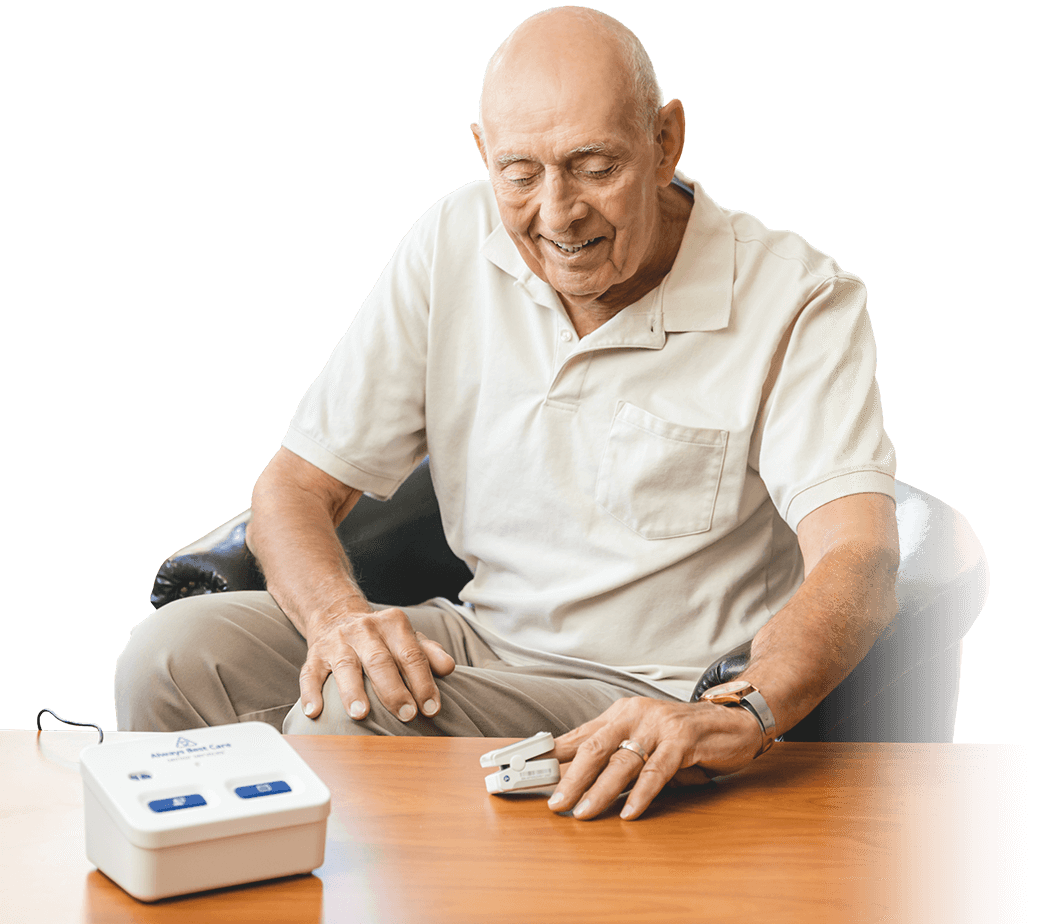
Providing around the clock data-based insights and recommendations
Always Best Care helps seniors and their family through the entire process. Our care coordinators are local and have in-depth knowledge of our senior living partners and services.

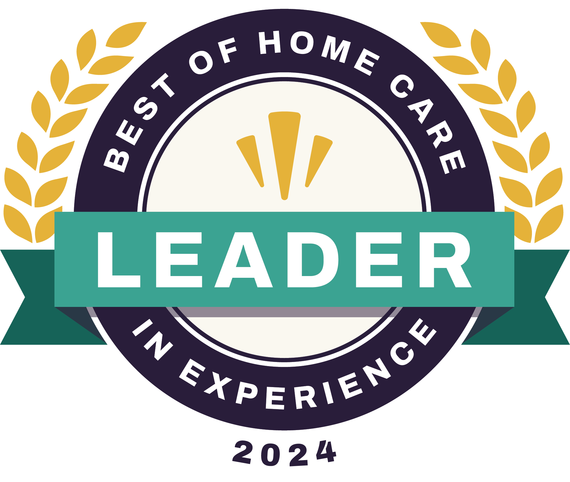
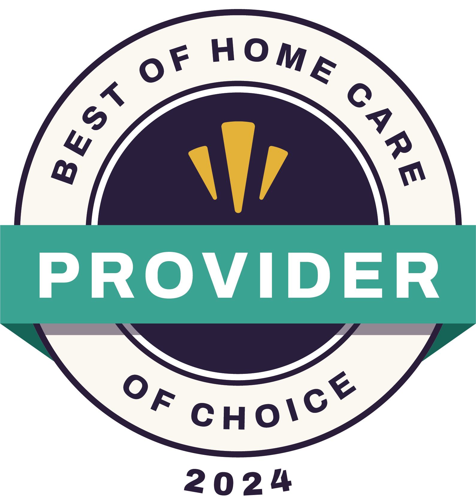
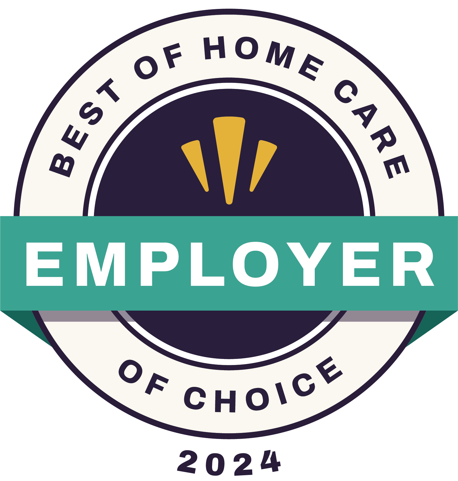
We are very proud of our awards and recognitions of excellence in the senior care industry
Our passion for helping people maintain a safe, independent and dignified lifestyle represents the strong foundation of
Always Best Care


Our employees are our own – not contractors. Caregivers are thoroughly screened, trained and insured. We are dedicated to exceeding your expectations…always.
Whether you are an experienced caregiver or looking to launch your career, contact us today to learn about opportunities that may be available in your area


Senior care services are for people who need ongoing assistance that cannot easily be provided by their family or friends. Studies show older adults prefer to live independent, non-institutionalized lives, and in-home care is a safe, effective way to provide care in the comfort of one’s own home.
The answer depends on the type of care, the location of care and the level of care that is needed. At Always Best Care, we provide a no obligation care consultation and provide information on many options for paying for home care for you and your loved one.
Our company vision is to work as a united team providing the best senior care in the world, with the broadest range of services, and the most loving and consistent care anywhere. We are dedicated to exceeding your expectations…always
Your Care Coordinator will work with you and your loved one to select the best qualified caregiver for each client. They will carefully review your care plan and try to match the right caregiver with the specific needs of each client. It is our goal and your right to make sure that you and your loved one are completely satisfied with our service and we will bend over backwards to make this happen.
Every Always Best Care location employs all their caregivers, so extensive background and reference checks are conducted. Caregivers are insured for your safety and they all receive extensive training upon being hired and on-going training to keep up with the demand of our industry. What this means for you is that you or your loved one will receive some of the best caregivers our industry has to offer.
The time frame to begin care for a senior will depend on the urgency of the need for the person and family that will be receiving care. That could mean care could start within hours, days or weeks, depending on your needs.
How people pay for senior care depends on their financial situation and the kinds of services they receive. Often, people must rely on a variety of payment sources, including personal funds, government programs, and private financing options.
Traditional Medicare does not pay for 24-hour-a-day care at your home, meals delivered to your home, homemaker services like shopping, cleaning, and laundry that aren’t related to your care plan, custodial, or personal care that helps you with daily living activities like bathing, dressing, or using the bathroom, when this is the only care that is needed.
Home-based care is part of the VA Medical Benefits. All veterans are eligible if they meet the clinical need and it is available.
Explore the latest insights, trends, and tips from the home care and caregiving industry
We have partnered with the best groups and institutions to provide the best care for you.